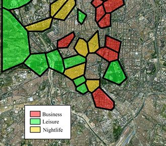
 Computer scientists believe that Twitter is a good way to aid urban planning and land use.
Brother and sister scientists Enrique and Vanessa Frias-Martinez have ussyed a report suggesting that geolocalised tweets can be used for urban planning. Vanessa is a scientist at the University of Maryland while her brother works for Spanish telco Telefonica.
According to Enrique Frias-Martinez, geolocalised tweets are useful for planning because of the number of people tweeting on where they are and what they’re up to.
He said: “Thanks to the increased use of smartphones, social networks like Twitter and Facebook have made it possible to access and produce information ubiquitously.”
He said that Twitter can include latitude and longitude and information can be captured more efficiently than by using questionnaires. It’s also far cheaper and more accurate than using traditional methods, he said.
The pair have mapped land use in New York, Madrid and London. The pair have published their paper in the journal Engineering Applications of Artificial Intelligence.


